Cahercommaun
Cliff fort/Stone fort
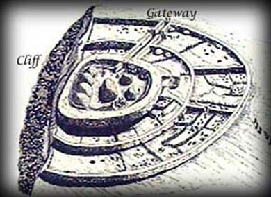
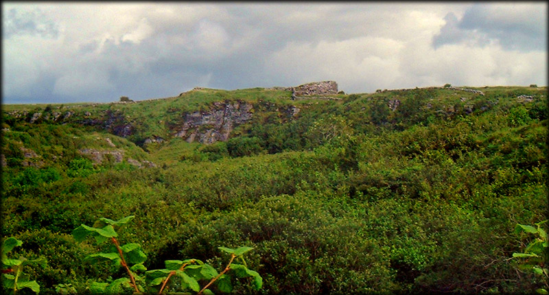
Cahercommaun Triple Stone Fort (stone fort of Comin) is dramatically situated on the edge of a cliff, all three of its concentric walls abutting the cliff edge. Built around 800 AD and remarkably similar to the great fort at Dun Aenghus on the Aran islands, the inner wall alone used 16,500 tons of stone and was almost a complete circle before the north wall fell down the cliff. The two outer walls were connected to each other by subsidiary walls. The outer wall covered an area 32.5 metres east/west by 28.6 metres north/south in diameter. The second rampart or inner wall is 1.5 metres thick and about 1.2m high and around 9 metres out from the inner caher. The fort was excavated in 1934 by the Harvard archaeological expedition which showed the enclosure had at least twelve stone buildings at varying times and a number of these had soutterrains.
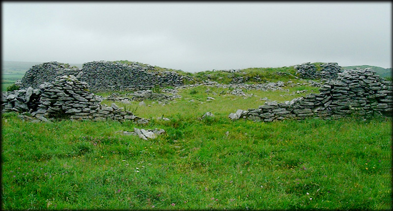
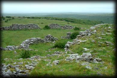
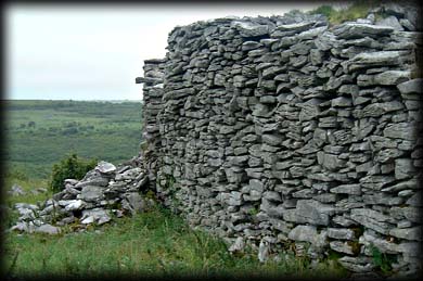
In the top picture you can see the inner caher walls rising up to some 3.6 to 4.2 metres above the cliff. It is almost impossible to photograph such large forts from ground level. The drawing below best illustrates the size and layout of this amazing monument. Other sites of interest in this area include Cashlaun Gar, Creevagh, Poulaphuca and Parknabinnia. There are over 900 stone forts/cashels in county Clare, at least ten of these are cliff-forts.
Situated:Take the R476 north from Kilnaboy then take the first right, after 3 kilometres you will come to a crossroads go straight through and at the next right stands a large house,to the right of the house is a pathway winding its way around the glen for about 1/2 mile towards the fort.
Discovery Map 51: R 2816 9652. Last visit August 2002.
Longitude: 9° 4' 14" W
Latitude: 53° 0' 53" N
Photos: Jim Dempsey.