|
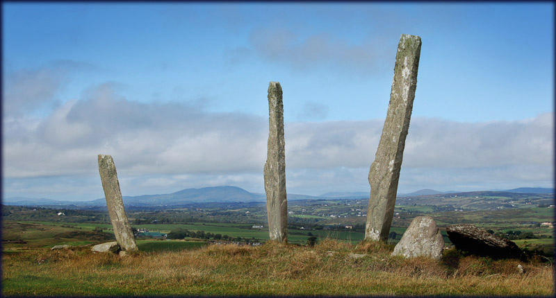
Gurranes AKA The Three Fingers Wow! what a fabulous site, I drove south down to Castletownshend from Ross carberry on a dull sunday morning hoping to visit the stone row at Gurranes. My first sight of the three fingers was a little uninspiring, three matchstick like stones standing up on top of a hill some 200 metres away, with grey clouds blowing across a menacing looking sky. In a small car-park next to the school, across from the churchyard, I was pondering my best approach, I asked a chap sitting in a jeep if he knew who owned the land, from that moment the day completely changed. He told me that he was the owner and also gave me the best directions to take to the row.
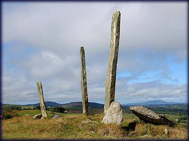
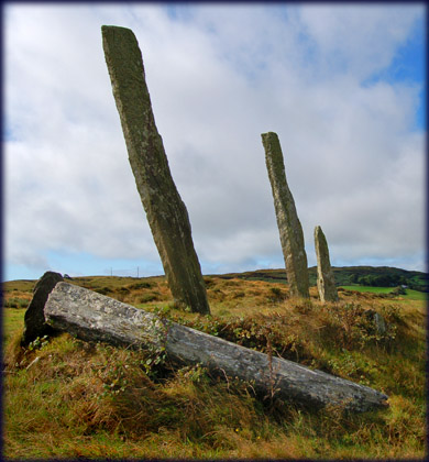
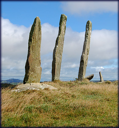
By the time I had reached the gate next to the track leading to Knockdrum fort, the sun had started to come out and the grey clouds had blown away, the sun then lit up the stones as I viewed them from Knockdrum. The stone row had originally five stones, the stump of the broken fourth stone can be seen below with the remaining piece lying prostate next to it, a fifth stone was removed to another location. This row is very impressive with the largest stone over 4 1/2 metres high. Not too far from here is Drombeg stone circle. |
|
 |
 |
|
View from Knockdrum |
|
|
Situated: From Skibbereen take the R596 towards Castletownsend after 5 kilometres you will see a school on your left and a church on your right, drive 500 metres passed the church till you see a gate on your left and a track on your right, this track leads to Knockdrum fort. To reach the row go through the gate on your left and straight across the field into the next field, keeping an eye out for some frisky bullocks. Discovery Map 89: W 1739 3156. Last visit Sept 2006. Longitude: 9° 11' 26" W Latitude: 51° 31' 51" N |
Photos: Jim Dempsey |