Kilfane
Church and Effigy
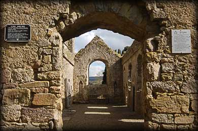
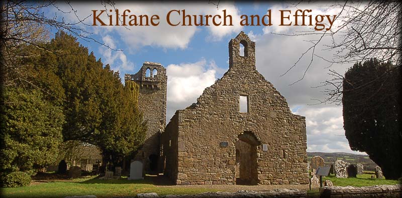
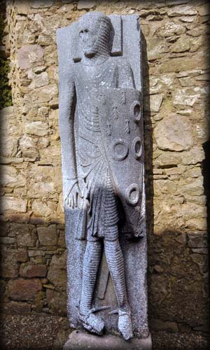
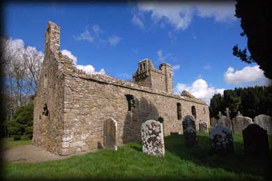
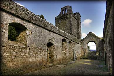
After being pleasantly surprised by the wonderful monastic site at Tullaherin we made our way to Kilfane. This lovely ruined 14th Century church is concealed by a grove of trees that has been invaded by a crow rookery. As we approached, the constant cacophony of caws suggested to us ruin and decay, but we were delightfully surprised to find a real treasure-trove of interesting and well-preserved features. Three original doorways in the north and south walls are headed by ogee stones that display the craftsmanship of the stonemason. Remains of an altar, piscina, book rest and multiple recesses all grace the interior walls. A 13th century sedilia near the altar is believed to have come from an earlier church at the site and still has traces of medieval paint. In addition, the church has an adjoining original 3-storey fortified presbytery and bell tower worthy of exploration. But the most amazing treasure is an effigy of a Norman knight in full armour carved from a single slab of limestone standing against the North wall. The Cantwell Fada (long man) is famous for its intricate detail, historical relevance, and at over two metres in height, the tallest such effigy in Ireland and Britain.
Chancel
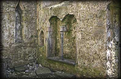
Sedilia
Situated: From Kilkenny take the R700 to Bennettsbridge. As you leave here take the first left. Drive for about 4 kilometres till you reach the N9. then take a right and then first left. The church is 300 metres along here on your right opposite the newer church.
Discovery Map 67: S 598 451. Last visit March 2011.
Longitude: 7° 7' 5.7" W
Latitude: 52° 33' 14.48" N
Photos: Jim Dempsey and Deb Snelson.